
Vegetation-loss alerts in Brazil's Amazon fell to 2,874.38 square kilometers between August 2025 and July 2026. The figure from Brazil's National Institute for Space Research represents a 36.87% year-on-year decline, the lowest level in the comparable Deter series that began in 2016, and an area 55.6% below the average of the previous ten cycles.
Deter uses satellite imagery to rapidly locate areas of vegetation clearing or degradation and direct enforcement operations. Because it is an operational system, an alert is not the same as a hectare definitively confirmed as deforested. The official annual rate is produced by the higher-precision Prodes system; the result therefore points to a favorable trend but should not be presented as the final forest-loss balance.
The decline was concentrated in several major states. Pará recorded 987.27 km² under alert, down 25.5% from the previous cycle; Mato Grosso had 834.41 km², a 49% decrease; and Amazonas fell 46.7% to 433.9 km². Acre reached 153.8 km², down 35.3%, while Rondônia registered 114.3 km², a 41.2% decline.
The map, however, was not uniform. Roraima accumulated 272.6 km² under alert, a 32.5% annual increase, an exception that requires continued territorial oversight even as the Amazon-wide total improves. The concentration of nearly two-thirds of the total in Pará and Mato Grosso also shows where enforcement capacity, investigations into illegal occupation and supply-chain monitoring remain decisive.
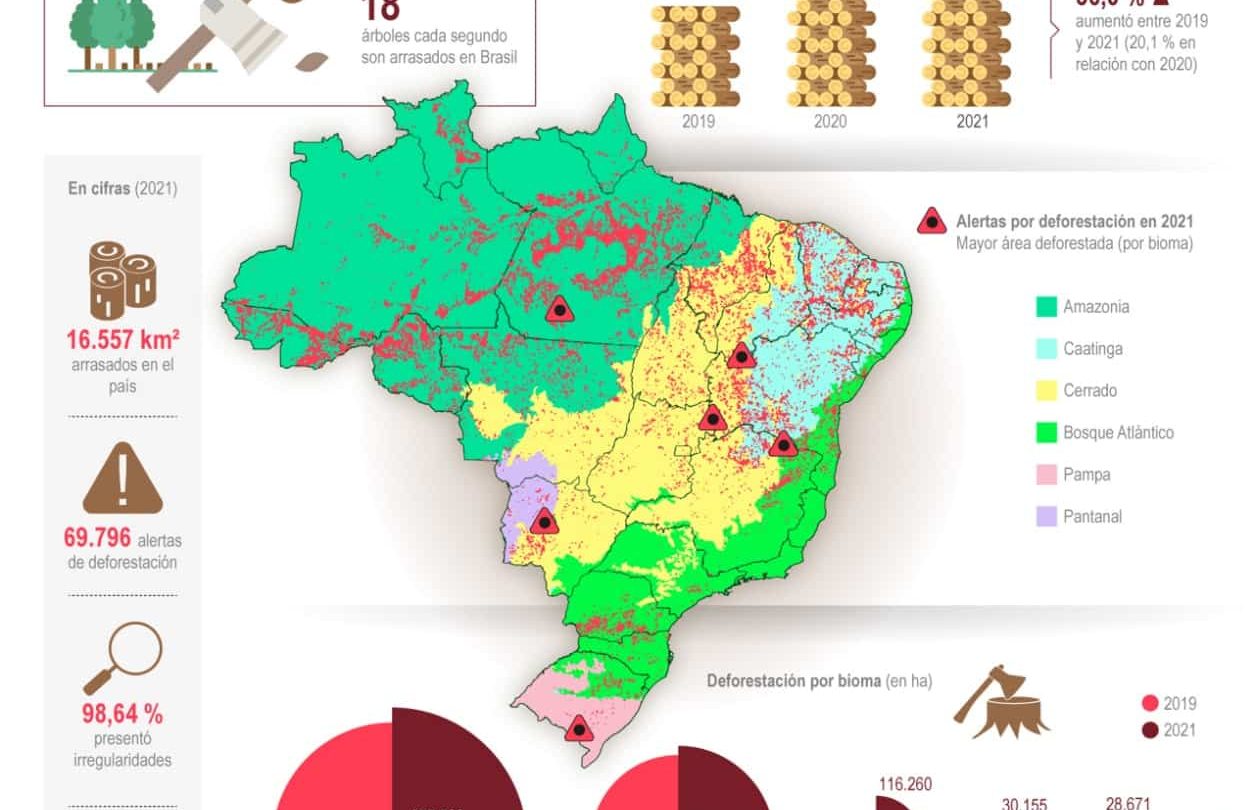
The Cerrado produced another positive but more moderate signal: 5,119.46 km² under alert, down 7.8% and the lowest level in five years. It also contained sharp contrasts: Piauí declined 51.2% and Bahia 27%, while Minas Gerais rose 72.5%, Mato Grosso 40.5% and Maranhão 2.1%. National improvement therefore coexists with expanding hotspots that can shift between biomes and jurisdictions.
Other Prodes results consolidated for the 2024-2025 cycle reinforced the downward trend: 2,289.54 km² deforested in the Caatinga, down 34.3%; 402.36 km² in the Atlantic Forest, down 15.32% and the lowest since 2001; and 305.48 km² in the Pampa, down 41.7%. Those figures cannot be mechanically combined with Deter alerts for the Amazon and Cerrado because they use a different method and cover a different period.
The next test is twofold: Prodes must confirm how much forest was actually lost, and authorities must show that the decline can be sustained without moving pressure into less-monitored territories. The record-low alerts provide room to consolidate enforcement policy, but they do not eliminate deforestation, degradation or their economic causes. Continued oversight and transparent data will determine whether the improvement endures.